Using LiDAR to help manage our River Murray flood response

The River Murray flood event presented many challenges, both to our business and the thousands of South Australians directly impacted. As flood-level predictions escalated, we commissioned Neara to digitally map our network and River water levels using LiDAR.
LiDAR is a technology that uses laser beams to measure distances and create 3D maps of the Earth's surface or objects. The data collected can then be used to create sophisticated modelling.
We had two clear areas of focus in our response to the floods – limiting the disruption of service to river communities and keeping River communities, emergency service providers and our workforce safe during and after the event, all while conforming to legislated powerline clearances.
Mapping the River was a significant undertaking as we have 21,000 spans of lines (a span is a section between two Stobie poles) along the 650 kilometre route of the River Murray through South Australia.
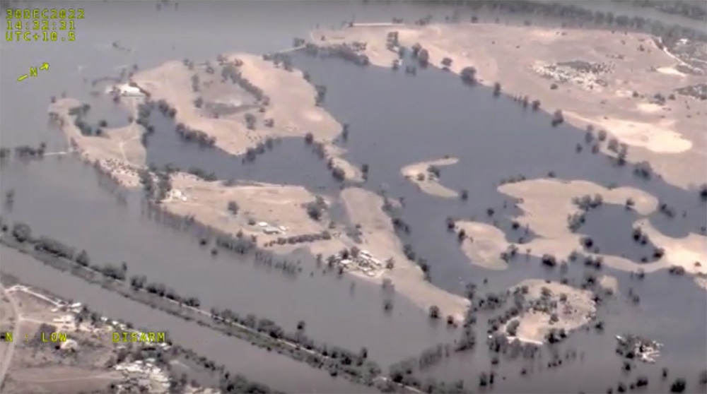
The data became available in late December as flood levels were about to peak. It gave us a 3D picture of our poles and wires and their relationship with water levels. During the worst of the flooding, we had 4000 Stobie poles and 400kms of powerlines standing in flood waters.
The 3D modelling meant we were able to delay or avoid some disconnections of supply for customers and also speed up reconnection by as much as three weeks as waters subsided from the peak. And, despite the significant inundation of electricity assets, we did not receive a single report throughout the entire event of an electric shock.
Responding to the flood event using data capture and analysis
As the scale of the event was becoming apparent and official estimates of flood levels started to rise significantly, we opted to leverage an active Network Management-led trial investigating ‘Next Generation Data Capture and Analysis’. At the core of this trial are two technologies:
- Light Detection and Ranging technology (LiDAR).
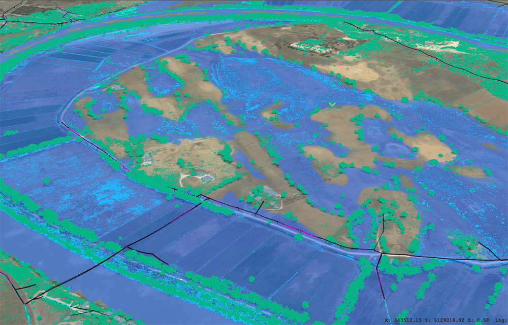
- Physical digital twin which uses the LiDAR data to create a 3D model of the SA Power Networks electrical assets and the associated environment.
It’s the first time we had used LiDAR-related technology in responding to an extreme weather-related event.
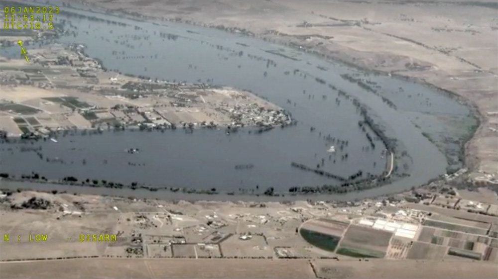
Picture: Flight plan over the Qualco area of the riverland during the LiDAR capture process.
How we did it
Over a five-week period, beginning in early December 2022, we used light aircraft flying at an altitude of 1200 to 1400 feet to capture LiDAR data associated with our assets located within the flood area. Conductors and their attachment points were our highest priority.
Trillions of LiDAR data points were captured over the 650km South Australian section of the river, at a resolution of 20 points per square metre. We used software to classify the LiDAR data (pole, conductor, building and terrain) and merged this with other data sources to create a digital twin of our network.
“Whether it be a pole or a conductor, we wanted to model water levels both in real time and at the flow rates that the government was forecasting,” Strategic Initiatives Manager Paul Topping said. “Just as importantly, we needed to be able to do that at scale and daily as the water levels varied. The flood water modelling was the biggest challenge the team had to solve,” Paul said.
The team overcame this challenge by ‘scraping’ data from various sources, including the Bureau of Meteorology and Murray Darling Basin Authority websites every five minutes for live water-level readings. Once calibrated, the LiDAR data had a validated accuracy of about 220mm.
After refining the measurements with verified test cases, we were able to start turning power on to areas ahead of the predicted timeframes. In some cases, up weeks earlier than would have been possible by deploying resources to manually assess the network.
We could also start proactively planning when we could get vehicles and crews back into these communities to perform restoration works in a safe and timely manner.
What’s next?
The technology has other potential future applications for SA Power Networks, including vegetation management.
SA Power Networks is also sharing the incredibly valuable data with various departments in the South Australian Government to assist with future planning and flood response.
This year promises to be a big one on our digital twin and LiDAR journey. Our Strategic Initiatives team will be looking at learnings from the flood event and determine ways to improve our response to this sort of event.
They will also be talking with a broad range of business stakeholders to understand how the technologies might be used more broadly across the business and to identify specific use cases that will provide the best return on investment.
Each link opens a larger version of the image